SINGAPORE - Following a spike in landslides here over the past two years brought about by heavy rainfall, Nanyang Technological University (NTU) researchers have created a soil database of Singapore that identifies slopes susceptible to such incidents.
The geospatial database enables planners and researchers to more efficiently pinpoint slopes where heavy rainfall could cause trees to fall and slopes to fail, NTU postdoctoral research fellow Li Yangyang said.
Climate scientists have warned that as the world warms, rainfall patterns could get more erratic - with periods of heavier-than-usual rain on some occasions and drier periods during others.
The database, created in collaboration with the National Parks Board (NParks), draws on soil investigation data from construction projects and about 20 years of the university's research on soil properties to model how the ground in Singapore will respond to rainfall.
It accounts for the presence of unsaturated soil, which commonly exists near the surface in tropical countries and is usually not recorded by engineers.
Understanding parts of Singapore with unsaturated soil is important because they have different properties as compared with saturated soil, said Ms Li, who co-authored a report on the soil database that was published in March.
While slopes made up of unsaturated soil can remain sturdy in dry weather, they tend to be destabilised by frequent and intense downpours because such soil absorbs more water.
"With the help of the soil database, which includes factors such as slope angle and the permeability of soil, we can simulate and analyse how large regions might respond to extreme weather conditions," added Ms Li.
She is also the holder of a Boustead-Esri Geospatial Scholarship, which allows Singapore citizens and permanent residents to pursue a postgraduate degree in geospatial technologies.
Given the limited records of unsaturated soil in Singapore, the researchers used machine learning to predict where they occur with limited samples.
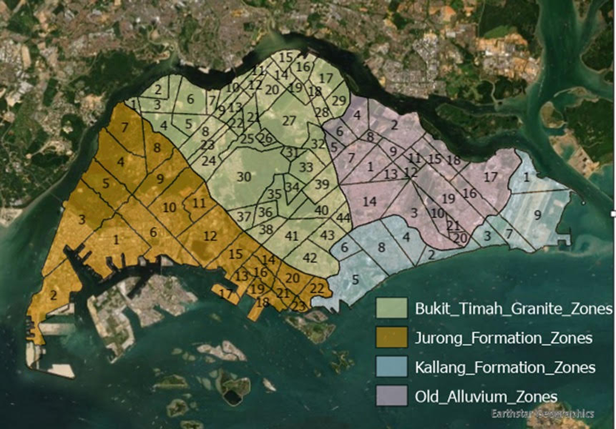
So far, the team has found retaining walls that support slopes at places they have identified to be sites of potential slope failure for four out of 97 zones in Singapore.

NParks' group director of the Centre for Urban Greenery and Ecology Lim Teck Lee said the soil database will help to map and update the daily soil-water balance near the ground surface, which affects plant health and tree stability, among other things.
The database comes as part of an increase in uptake of geospatial technology here, with the authorities, including the Urban Redevelopment Authority, using such technology to help design, build and perform urban simulations.
However, there is currently little undergraduate training in the use of geographic information system training in most tertiary institutions in Singapore, said Mr Leslie Wong, managing director of technology company Esri South Asia.
He added: "While courses such as environmental sciences do prepare us with future talent that is well-positioned to leverage geospatial methods and technology, the vast numbers in other disciplines such as engineering and mathematics do not seem to provide sufficient exposure to this."